 April 28 2018
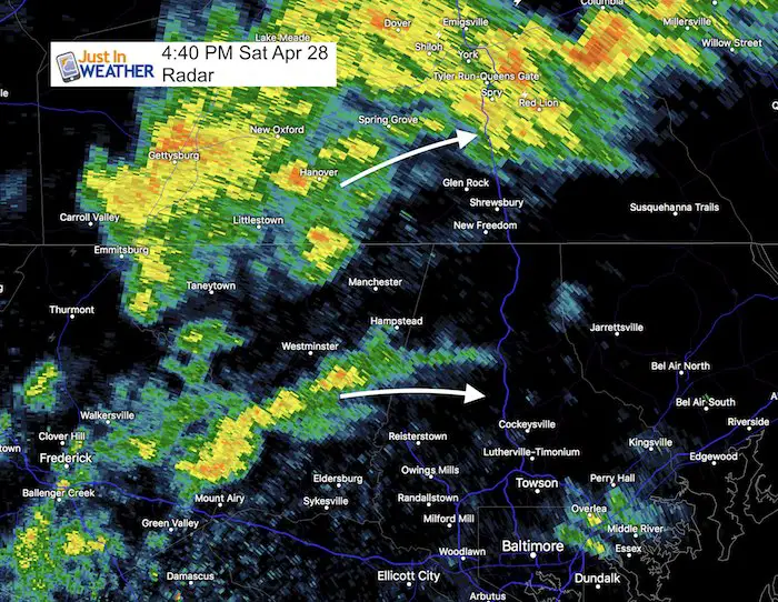
We made it into the 70s and now a cold front is trying to put some of that heat to work. A line of showers with some lightning and thunder has developed. This will be moving through our region this evening, but stall for a few hours. After the initial burst that may bring some heavy cells and lightning, rain showers will liner overnight.
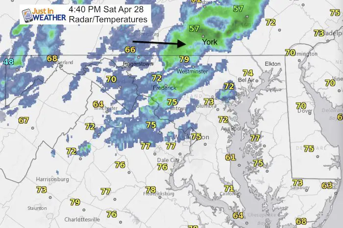
Here is a look at the radar simulation, but it is NOT EXACT! Compare the radar at 4:40 pm to the simulation for 5 PM and see it is not precise… but this should give you a idea of how this will progress.
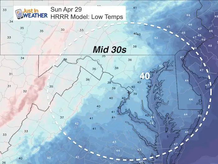
This will bring in colder air that will surely be felt by morning. Sunday afternoon’s highs may be where our morning lows were today… in the 50s.
Local Radar at 4:40 PM
This is not lined up perfectly with the simulation below…
Rain Timeline –> slider
[metaslider id=61559]
Sunday Morning Low Temperatures
Keep In Touch Every Day
Click here to sign up for email alerts…. Just in case you don’t get the post on your social media feed
![]()
Shine On
Proceeds from all sales go to Just In Power Kids. Click the image to shop and show your support.

 Get the award winning Kid Weather App I made with my oldest son and support our love for science, weather, and technology. Our 3 year anniversary of the release and our contribution to STEM education is this November. It has been downloaded in 60 countries, and works in both temperature scales. With your support we can expand on the fun introduction to science and real weather.