Tuesday April 24 2018
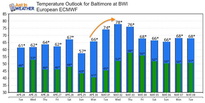
The clouds are back and so is the chilly wind. The flow from the east today is piling in the moisture and will eventually feed into rain developing today. Showers will develop in the afternoon and eventually spread to a steady rain by this evening. We are in a pattern that will keep us damp tomorrow, and another round of rain on Friday. There is hope however that after this chilly last week of April, next week will be much warmer just as we turn the page to May.
Stats For April 24
Average High: 68ºF
Record High: 93ºF in 1960
Average Low: 45ºF
Record Low: 32ºF in 2003
Snow Record: Trace in 1930
Seasonal Snow To Date (at BWI): 15.2
Sunrise: 6:39 AM
Sunset 8:03 PM
*Daylight = 2:00 longer than yesterday
*Bay Water Temperature = 52ºF at Thomas Pt. Light House
Keep In Touch Every Day
Click here to sign up for email alerts…. Just in case you don’t get the post on your social media feed
Morning Weather
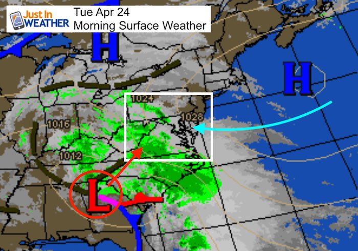
High Pressure in the Atlantic is responsible for the easterly wind and will keep our temperatures on the cool side. While we start in the 50s, the high is only expected to rise a few degrees. The storm centered over Atlanta will slowly spread north, bring in the rain later today and tomorrow.

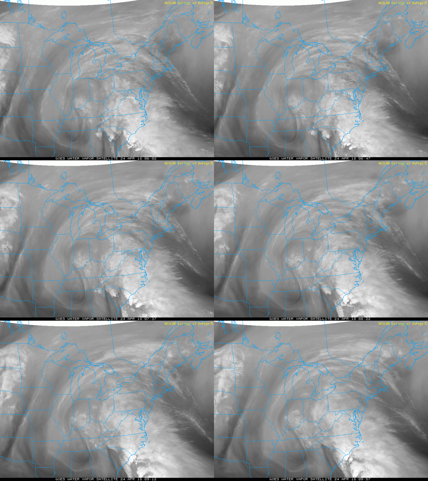
Satellite Loop
Radar Simulation —> slider
[metaslider id=61388]
Storm Trend Through Friday Morning
Temperature Outlook

Keep In Touch Every Day
Click here to sign up for email alerts…. Just in case you don’t get the post on your social media feed

Shine On
Proceeds from all sales go to Just In Power Kids. Click the image to shop and show your support.
 Get the award winning Kid Weather App I made with my oldest son and support our love for science, weather, and technology. Our 3 year anniversary of the release and our contribution to STEM education is this November. It has been downloaded in 60 countries, and works in both temperature scales. With your support we can expand on the fun introduction to science and real weather.


