 Tuesday March 27 2018
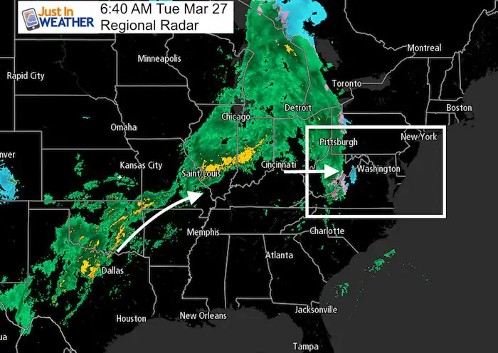
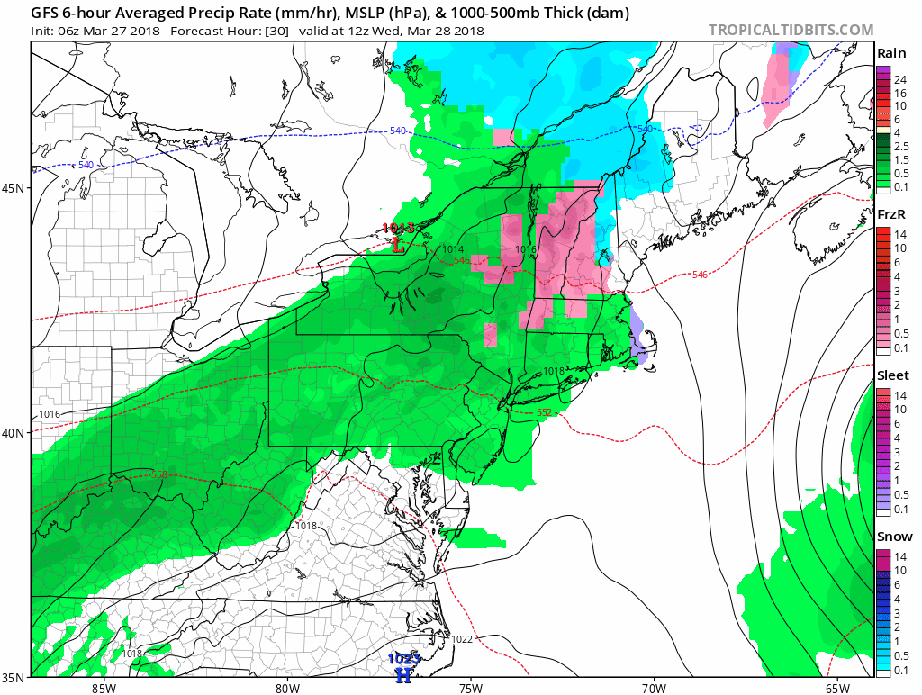
Looking at the radar this morning we can see a large amount of rain from Texas to the Great Lakes. This is a stalled system that will send pulses of rain our way during the way, starting with today. The leading edge has some snow in the mountains, and we could have a little sleet mixed in as the ‘stuff’ arrives today. But this is the leading edge of warmer air that will break into Maryland over the next few days. There is a trade off as we aim for the 60s, there will be some showers. At this time, Opening Day for the Orioles may catch a break over Baltimore, but the threat of wet weather will be with us almost each day into the weekend.
Stats For March 27
Average High: 58ºF
Record High: 86ºF in 1921
Average Low: 37ºF
Record Low: 20ºF in 2014
Snow Record: 0.4″ in 1924
Seasonal Snow To Date (at BWI): 15.2″
Sunrise: 6:58 AM
Sunset 7:25 PM
*Daylight = 2:35 longer than yesterday
*Bay Water Temperature = 42ºF at Thomas Pt. Light House
Also See: Snow Report March 20-21 2018
This Morning

Afternoon

Radar Simulation —> slider
[metaslider id=60689]
Rain Outlook This Week
Orioles Opening Day
There will be some showers, but not a washout. It is possible to get a little wet, but the game should get in. Temps will be reaching the upper 60s

Temperature Outlook

Shine On
Proceeds from all sales go to Just In Power Kids. Click the image to shop and show your support.

Keep In Touch Every Day
Click here to sign up for email alerts…. Just in case you don’t get the post on your social media feed
Please share your thoughts, best weather pics/video, or just keep in touch via social media
-
Facebook: Justin Berk, Meteorologist
-
Twitter: @JustinWeather
-
Instagram: justinweather
 Get the award winning Kid Weather App I made with my oldest son and support our love for science, weather, and technology. Our 3 year anniversary of the release and our contribution to STEM education is this November. It has been downloaded in 60 countries, and works in both temperature scales. With your support we can expand on the fun introduction to science and real weather.
Also See:
My Winter Outlook 2017-2018 for more snow
La Nina Formed: What it could mean to our winter
NOAA Winter Outlook: Not The Best But Not The Worst For Snow
Two Farmers Almanacs Winter 2018 Outlooks
Winter Weather Folkore: Suggestions from Animals and Crops
First Frost and Freeze Dates For Maryland (southern PA and northern VA)
My Preliminary Winter Outlook Notes
Low Snow Winters In Baltimore: To Repeat Or Not Repeat
NOAA Ranks Blizzard 2016 4th Worst Snowstorm On Record
Blizzard 2016 Record Top Snowstorm: Area Totals
Extreme Weather of 2015 balanced out on both ends