Thursday March 1 2018
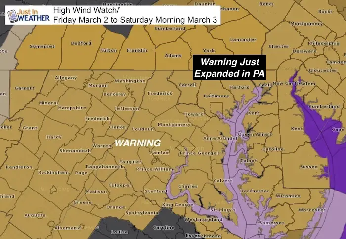
By now you may have heard we have a High Wind Warning and could see gusts up to 70 mph. That is well into tropical storm intensity and lasting much of the day. This storm will be potent and carry a few parts to it. The rain overnight will mix with and change to snow by daybreak as the cold air was around the strong Low Pressure. This snow should spread across southern PA into metro DC and central Maryland toward the Eastern Shore. Now that the High Resolution Rapid Refresh Model has caught on to it, I have an hourly timeline slider below.
The snow will fall on warm ground and with temperatures above freezing. Stickage should be limited to grassy areas, but some intense bands might briefly cause some slush on some pavement. The main issue for Friday will be the wind. While I had posted in prior reports that it will increase all day, there will be a bout of intense wind in the morning. The will develop quickly and add to the confusing weather. See that timeline below as well.
Snow Timeline: HRRR Model
—> slider
[metaslider id=59172]
Remember The High Wind Warning Includes all of our region
Why is this wind such a big deal?
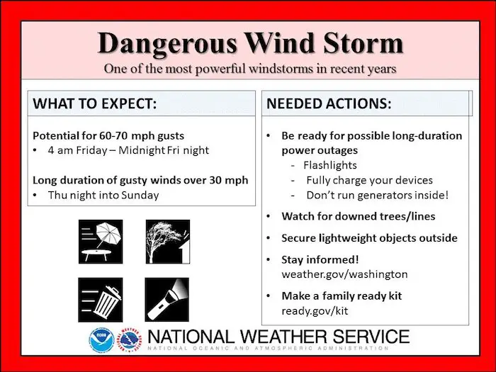
A few people have commented that we have seen gusts before to 60 mph and the expectation of 70 mph is limited. Well, yes, but this is NOT a severe thunderstorm that comes and goes quickly. This wind storm will be with us most of the day and last into Saturday. The duration of the strong winds pounding on trees stuck in soggy soil may be enough to fall over. Branches can easily break loses and fly around. Other objects may fly and lead to damage and debris as well.
This special graphic was sent out by The National Weather Service to highlight this event
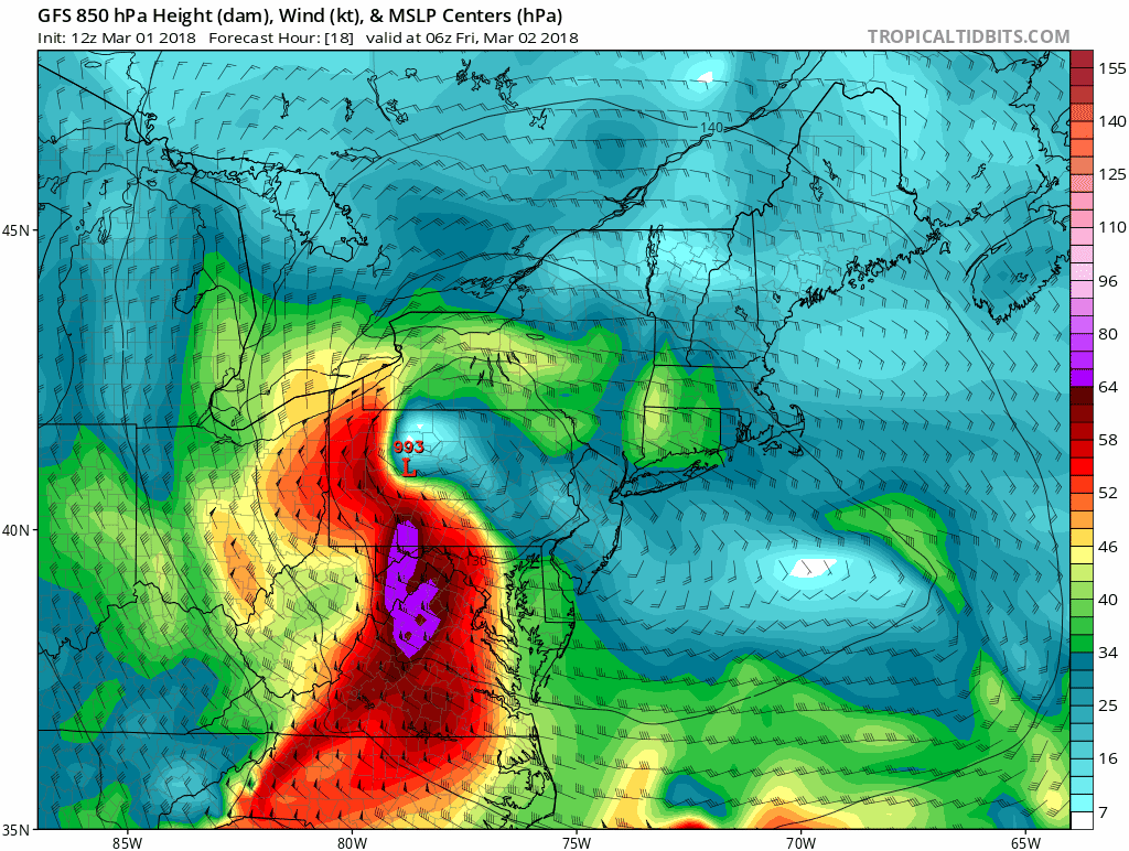
Wind Speed Timeline
—> slider
LEGEND:
- Yellow: 34 knots= 39 mph *Tropical Storm Force
- Orange: 42 knots = 48 mph
- Red: 50 knots = 58 mph
[metaslider id=59155]
See more about the rest of the day in my prior report (click here) or read the highlights below
Storm Highlights:
- Winds increase before daybreak
- Snow may fall at daybreak and all morning. But the ground is too warm and the surface air should remain above freezing. So stickage is not expected.
- Visibility may be low in the morning with snow falling with increasing winds
- Winds will increase all day. Strongest winds will be mid afternoon and evening.
- LOW WATER: The wind flow from the northeast may drain water OUT OF THE BAY. The rain fall still has to drain out, so I expect the lowest Bay water levels will be Friday night and into Saturday.
- Winds speeds are likely to be between 30- to 45 mph. Wind gusts will reach over 50 mph for most areas and some can hit the 60 to 70 mph range.
- Winds will remains strong but ease a little Saturday. Then improve Sunday.
Impact:
- Restrictions on bridges
- High Profile vehicles will be easily pushed around
- Busses, vans, and SUVs can get pushed around. Honestly, cars too.
- Airline travel is likely to be delayed or postponed. If you fly, it will be very turbulent.
- Trees can fall over thanks to soggy soil.
- Power outages likely
- Schools: I have no idea what they will decide.
Please share your thoughts, best weather pics/video, or just keep in touch via social media
-
Facebook: Justin Berk, Meteorologist
-
Twitter: @JustinWeather
-
Instagram: justinweather
Keep In Touch Every Day
Click here to sign up for email alerts…. Just in case you don’t get the post on your social media feed
FITF Gear

Snowstix- We Need You To Measure Snow Too
We are giving 10% of each sale to programs that benefit pediatric oncology patients.

 Get the award winning Kid Weather App I made with my oldest son and support our love for science, weather, and technology. Our 3 year anniversary of the release and our contribution to STEM education is this November. It has been downloaded in 60 countries, and works in both temperature scales. With your support we can expand on the fun introduction to science and real weather.
Keep In Touch All Winter
Click here to sign up for email alerts…. Just in case you don’t get the post on your social media feed
Also See:
My Winter Outlook 2017-2018 for more snow
La Nina Formed: What it could mean to our winter
NOAA Winter Outlook: Not The Best But Not The Worst For Snow
Two Farmers Almanacs Winter 2018 Outlooks
Winter Weather Folkore: Suggestions from Animals and Crops
First Frost and Freeze Dates For Maryland (southern PA and northern VA)
My Preliminary Winter Outlook Notes
Low Snow Winters In Baltimore: To Repeat Or Not Repeat
NOAA Ranks Blizzard 2016 4th Worst Snowstorm On Record