 Wednesday September 27
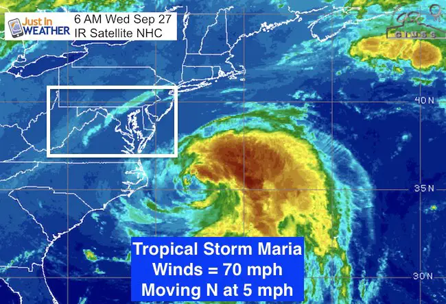
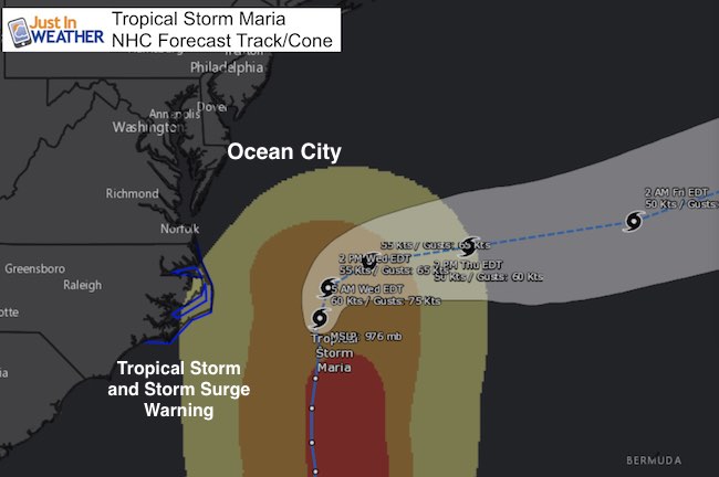
Maria is down to Tropical Storm strength today. Winds are 70 mph and it is located a little more that 200 miles from Ocean City, MD. This is about the closest it will get, but will spread one or two bands of showers to the beaches. The main influence will be high surf for a few days. Otherwise, this falls in line with Jose as a coastal storm staying farther east.
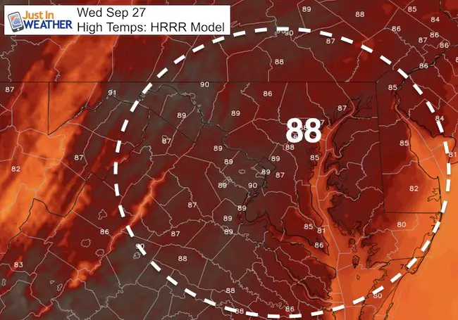
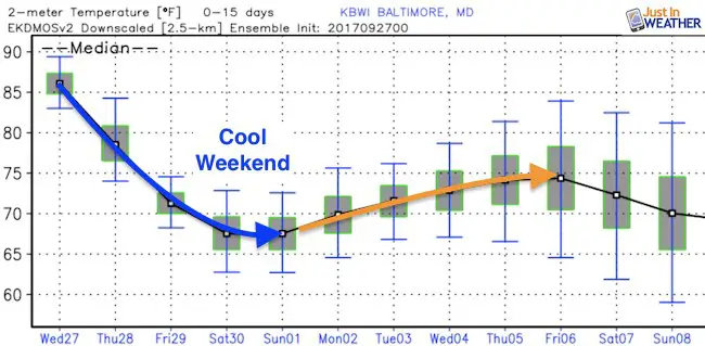
Today will be hot, rain will be confined to the lower Eastern Shore, and then we have a cooling trend into the weekend.
5 AM Stats
LOCATION…35.1N 72.9W
ABOUT 145 MI…235 KM E OF CAPE HATTERAS NORTH CAROLINA
MAXIMUM SUSTAINED WINDS…70 MPH…110 KM/H
PRESENT MOVEMENT…N OR 5 DEGREES AT 5 MPH…7 KM/H
MINIMUM CENTRAL PRESSURE…976 MB…28.82 INCHES
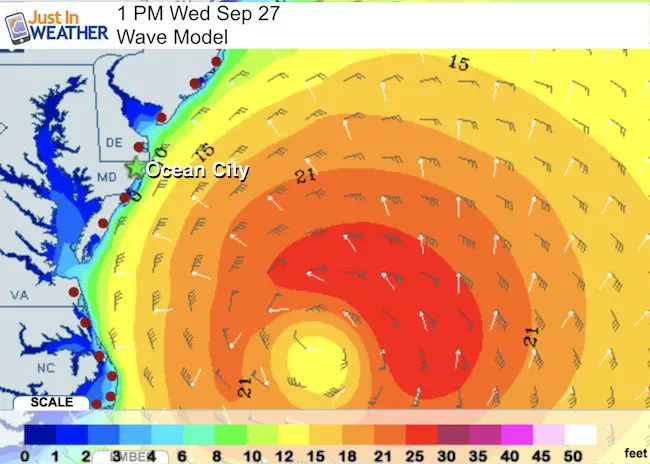
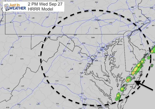
Waves For Ocean City
Winds along the beach may gust 30 to 40 mph. The waves will be high and rip currents likely to last for a few days.
Change On The Way
The cold front that will push it away will swing through today with little more than a wind shift. Most of us remain dry but cooler air will filter in after one last warm day. Highs will be in the upper 80s to near 90ºF.
Chance of Rain?
There will be one or two bands of rain that move onshore from the ocean but won’t make it much farther inland.
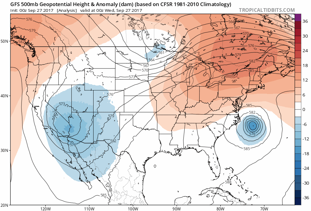
Forecast Outlook
This look at jet stream level heights reflects the temperatures. The coolest weather settles in this weekend with highs in the 60s and lows in the 40s. Real Fall! Temps will modify next week and we should be back into the mid 70s by the end of next week.
Temperatures
 Get the award winning Kid Weather App I made with my oldest son and support our love for science, weather, and technology. Our 3 year anniversary of the release and our contribution to STEM education is this November. It has been downloaded in 60 countries, and works in both temperature scales. With your support we can expand on the fun introduction to science and real weather.
Please share your thoughts, best weather pics/video, or just keep in touch via social media
-
Facebook: Justin Berk, Meteorologist
-
Twitter: @JustinWeather
-
Instagram: justinweather