 8 PM Sunday August 6
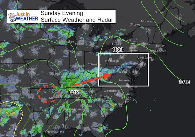
Plan for a cool and wet day Monday. Another storm is heading our way and it will dominate the start of the work week. Today Baltimore barely hit 80ºF at BWI, but many places just inland stayed in the 70s. The next storm will try to move warmer, unstable air in overnight along a warm front. But this will likely not get north of Rt 50, if that far tomorrow.
Showers are already showing up on radar ahead of this system, and that will continue to spread in this evening. Monday the center of Low Pressure will be passing right over central Maryland. This will keep rain around most of the day, with the threat of severe storms during the afternoon and evening.
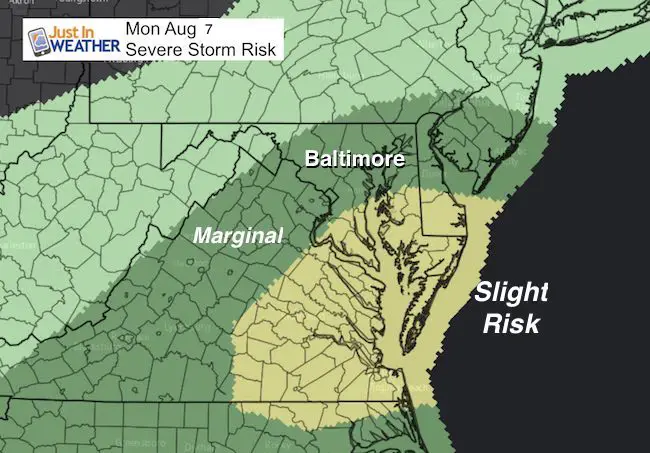
The track of Low Pressure is important since it will keep the risk of severe storms primarily to the east or warmer side. But something spin right around the center may enhance the rain and instability. If this sets up the right way, almost like a Fall or Winter event… there could be a heavy band of rain on the north side of the Low. That shows up on the GFS Mode. Rainfall could exceed 2 inches leading to local flooding. In severe storms there will be a risk of large hail, damaging winds, and isolated tornadoes.
Here are two sliders: First at the timeline for rain in the morning and then the track of the storm in the wider view on the GFS Model. I want to note that this did a good job with timing and location in our storm last week. So lets see if this can do it again. Please see my notes below the sliders…
Monday Morning Rain
Simulated Radar—> slider
[metaslider id=50737]
Notes:
- There may be a break near and north of Baltimore in the morning. Rain is likely to remain steady all morning near Baltimore, Washington, Annapolis and south.
- Rain will continue through the afternoon and at night.
- The risk of severe storms will build mid afternoon and into the evening, mainly near and east of the Chesapeake Bay
Tracking The Storm —> slider
[metaslider id=50722]
Notes:
- Notice the band of moderate to heavy rain through the afternoon and evening
- The Low Pressure tracks right over central Maryland
- Tuesday should be nice in central Maryland snd southern Pennsylvania.
- Tuesday may stay wet at the beaches
Please share your thoughts, best weather pics/video, or just keep in touch via social media
-
Facebook: Justin Berk, Meteorologist
-
Twitter: @JustinWeather
-
Instagram: justinweather
 Get the award winning Kid Weather App I made with my oldest son and support our love for science, weather, and technology. Our 3 year anniversary of the release and our contribution to STEM education is this November. It has been downloaded in 60 countries, and works in both temperature scales. With your support we can expand on the fun introduction to science and real weather.
Maryland Trek 2017
Donations now being accepted. Please select “Cool Kids Campaign” in the options to add to our entire team’s total.
Milestones this year:
- I will do my 1000th mile on Day 1 in Garrett County
- We aim to reach $100,000 for Cool Kids Campaign for the entire event.

Faith in the Flakes
The store is closing for the season. Next week we wil be shifting back to spring mode. This will include a severe weather STEM assembly program.
-
Sign up for email updates on new posts
Since you may miss some posts via social media, click here for email alerts as a way to make sure you don’t miss any. *You may have to refresh that page once for your browser to clear out the images.
Also See: