Thursday August 3
We remain in this humid environment on the edge of High Pressure that allows the storms to buildup, but not much push to move them. So as they sit or drift, then can dump a lot of rain on some areas. There is less trigger today, so storms should be less numerous, but they will still develop and do their thing. This could bring local flooding, large hail, damaging winds, and intense lightning. Before checking out the radar simulation, I want to take a look back at yesterday’s rain that produce Flash Flooding and severe wind damage.
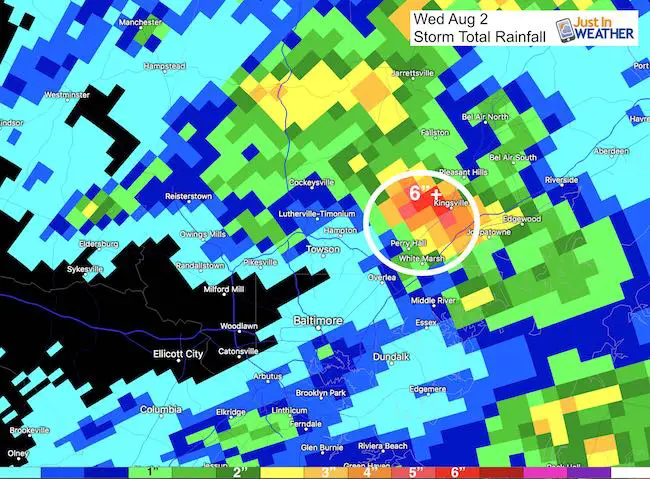
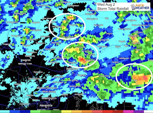
Wednesday’s Flooding
Here is the Doppler Radar Rainfall Totals. The big hit was just west of Kingsville, MD around Glen Arm with over 6 inches of rain. Large hail and tree damage was noticed even in other cells across the area.
Baltimore’s BWI recorded 0.68″ of rain. Woodlawn and Ellicott City remained dry. Yet Perry Hall to Bel Air ranged between 1 and 6 inches.
As we noticed during the day, storms formed on the north side, and the outflow boundary helped to spawn more storms to the south… but not as potent….
Today:
Highs will once again be in the upper 80s to near 90ºF, and scattered storms will develop. Today’s storms should start after 2 PM, a few hours later than yesterday. This suggests the atmosphere is a little more stable and needs a little more heat to pop the cork and get going.
—–> slider: Radar Simulation
[metaslider id=50521]
- Severe Storms With Large Hail: Any storm may produce quarter size hail
- Frequent lightning
- Winds exceeding 60 mph
- Flash Flooding
- Watch means it ‘might’ happen’; Warning means it ‘is happening’
High Temperatures:

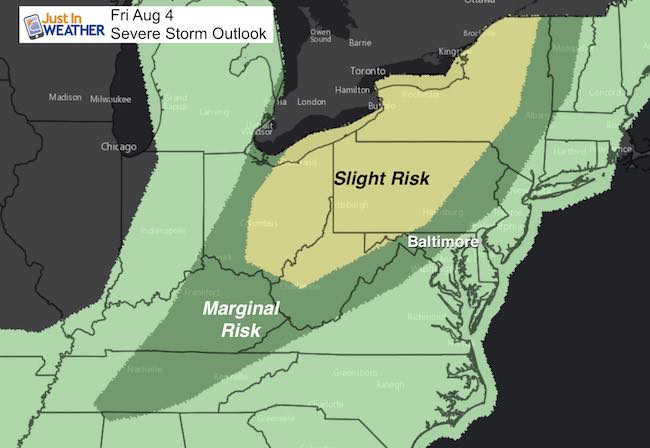
Severe Storm Outlook
This product from NOAA did not show the outbreak over the past two days… Once reason I have not been showing it. But I wanted to show the shift of energy today and tomorrow… It looks like Friday will be our best chance for an active day. More energy will be north of Baltimore across the mountains and southern PA
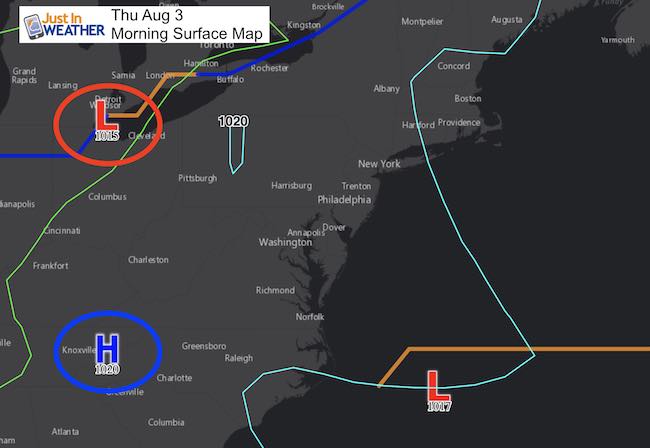
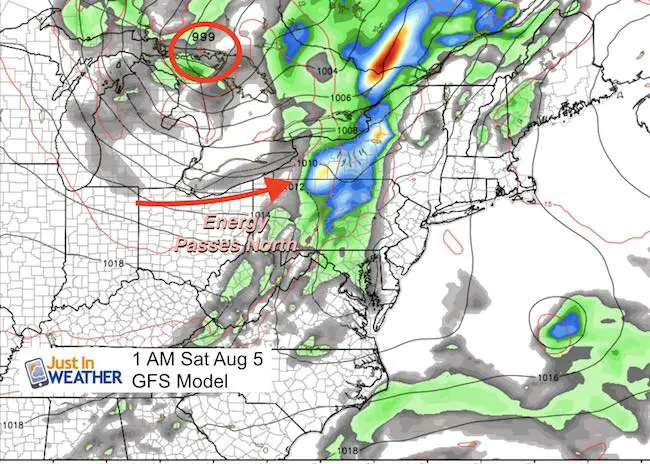
Weather Map:
As the main Low Pressure passed through the Great Lakes, the energy will be riding along the mountains
Please share your thoughts, best weather pics/video, or just keep in touch via social media
-
Facebook: Justin Berk, Meteorologist
-
Twitter: @JustinWeather
-
Instagram: justinweather
 Get the award winning Kid Weather App I made with my oldest son and support our love for science, weather, and technology. Our 3 year anniversary of the release and our contribution to STEM education is this November. It has been downloaded in 60 countries, and works in both temperature scales. With your support we can expand on the fun introduction to science and real weather.
Maryland Trek 2017
Donations now being accepted. Please select “Cool Kids Campaign” in the options to add to our entire team’s total.
Milestones this year:
- I will do my 1000th mile on Day 1 in Garrett County
- We aim to reach $100,000 for Cool Kids Campaign for the entire event.

Kent Island Tornado
Doppler Radar Loop: Likely Tornado On Kent Island July 24
Tornado Damage Photos On Kent Island: July 24 2017
Waterspout Video and Photos July 15 2017
Waterspouts photos August 21 2016
Faith in the Flakes
The store is closing for the season. Next week we wil be shifting back to spring mode. This will include a severe weather STEM assembly program.
-
Sign up for email updates on new posts
Since you may miss some posts via social media, click here for email alerts as a way to make sure you don’t miss any. *You may have to refresh that page once for your browser to clear out the images.
Also See: