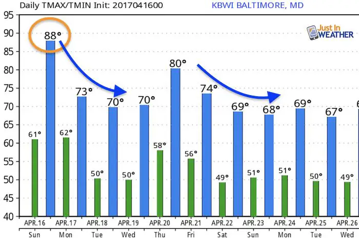
Sunday April 16 – A line of thundershowers moved through central Maryland and Delmarva Saturday night that was a bit of a surprise. While it was beneficial to gardens and taking some pollen out of the air, it also has been responsible for morning fog. Today will see a push of warm air that will bring the sun back and push temps into the mid and upper 80s. Today’s record high at BWI was 90ºF set in 2012. While it will be close, we should stay below that mark thanks to the build up of clouds. Should that hold off longer, then it could be closer.
That same weakness in the atmosphere will spark some showers and storms late today. The good news is that most of today will be dry. Some scattered showers will pop in the afternoon, but let’s focus on later in the day towards evening with the best chance for most of us. A cold front will actually move through Monday morning, that will take our temperatures back closer to reality again.
Simulated Radar
Considering the cluster of rain last night that did not fit the simulation, I need to add the disclaimer again that this projection is not perfect. It is a guide but not gospel. So I will make another post during the afternoon to see if there are any adjustments on the location and expectation of rain.
—> slider
[metaslider id=46549]
Monday- Front Nearby
Morning – The front will be weakening, but may provide some showers around sunrise.
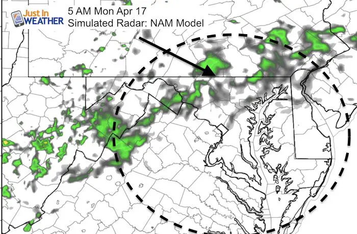
Evening- The front may stall in central Maryland during the day or move south and then drift north again. The main rain bands will be south… however if the front does linger north we could be in for another round of rain in the evening. 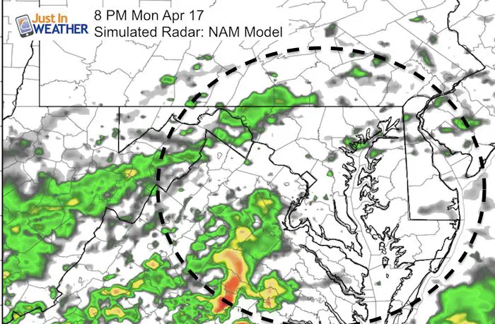
Rain chances next week
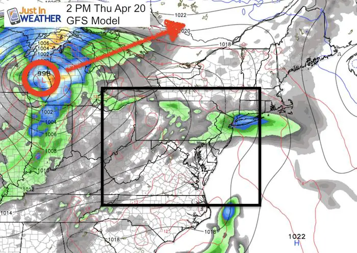
The Thusday event will bring severe storms to The Ohio Valley and Great Lakes… but the timing and track pushes the energy to our north Thursday night…
8 Days Away….
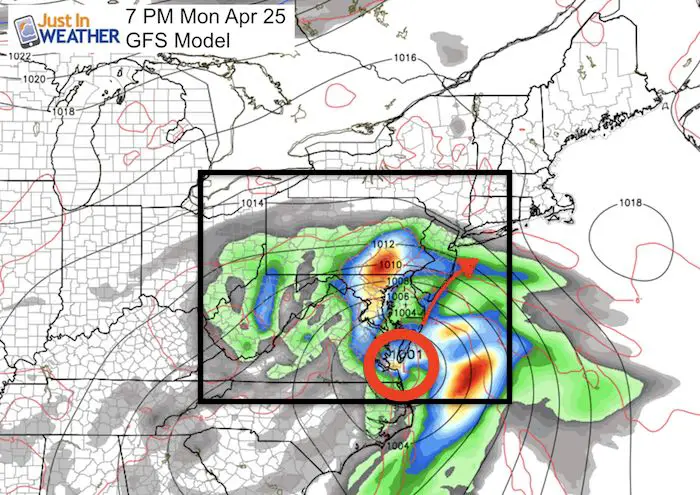
The farther out in time, the lower the chances of pinning down the time and location….
This looks like a coastal storm with potential for heavy rain. Take this with a grain of salt. I am posting this for posterity. So we can compare and see if the models are any better with long range forecasting in spring than the horrible display last winter.
Temperature Outlook
LASIK and Free Sunglasses

Storm Smart: My STEM Assembly Program
Click here to see the details and how this educational program is also a fundraiser for schools. We can start scheduling for May now.
 Get the award winning Kid Weather App I made with my oldest son and support our love for science, weather, and technology. Our 3 year anniversary of the release and our contribution to STEM education is this November. It has been downloaded in 60 countries, and works in both temperature scales. With your support we can expand on the fun introduction to science and real weather.
Please share your thoughts, best weather pics/video, or just keep in touch via social media
-
Facebook: Justin Berk, Meteorologist
-
Twitter: @JustinWeather
-
Instagram: justinweather
Faith in the Flakes
The store is closing for the season. Next week we wil be shifting back to spring mode. This will include a severe weather STEM assembly program.
-
Sign up for email updates on new posts
Since you may miss some posts via social media, click here for email alerts as a way to make sure you don’t miss any. *You may have to refresh that page once for your browser to clear out the images.
Also See:
Extreme Weather of 2015 balanced out on both ends


