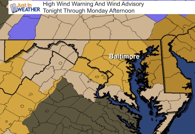
 Sunday February 12 – A strong storm is passing to our north and will intensify off of the coast. Rain is passing through this morning as we are right on the edge. To our south, temps the Shenandoah are approaching 70°F, while snow is well to our north and will make a return to the western Maryland mountains tonight. That is when cold winds will up and possibly gust to 60 mph. Metro Baltimore is under a High Wind Warning as a result. Wind Advisories have been posted for southern Pennsylvania. The peak of the winds will be overnight and into Monday. See the timeline below the radar simulation
Radar Simulation —> slider HRRR Model
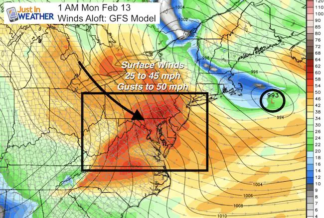
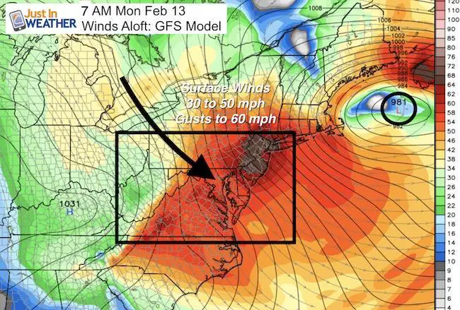
Wind Forecast
Top winds will kick up after midnight. It may wake you up with flying branches and rattling shutters.
Wind Timeline —> slider NAM Model
[metaslider id=43410]
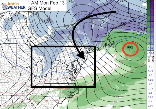
Strong Storm To Our North
Will we have snow during the week?
There has been chatter about the European Model that showed snow Wednesday/Thursday. As of now, the computer model consensus splits the energy and does not allow that storm to take form. However, I think there is some model error with the energy location… so we may have at least a chance of snow showers. I will have more on that in my evening post.
 Get the award winning Kid Weather App I made with my oldest son and support our love for science, weather, and technology. Our 3 year anniversary of the release and our contribution to STEM education is this November. It has been downloaded in 60 countries, and works in both temperature scales. With your support we can expand on the fun introduction to science and real weather.
Please share your thoughts, best weather pics/video, or just keep in touch via social media
-
Facebook: Justin Berk, Meteorologist
-
Twitter: @JustinWeather
-
Instagram: justinweather
Faith in the Flakes Online- Flannel PJs Printed Inside Out
Store Now Open

- We’ve added Flannel PJ Pants that will be printed inside out. They have to be, to make it snow ?
- Free Personal Delivery for orders of 20 items or more to schools and businesses.
- Click this image for the online store.
- Look for more items to be added soon.
- Also see the info for the STEM Assembly Spirit Wear program: Put your school name on the shirts and raise money for you PTO/PTA in the process.
Sign up for email updates on new posts
Since you may miss some posts via social media, click here for email alerts as a way to make sure you don’t miss any. *You may have to refresh that page once for your browser to clear out the images.
FITF SNOW STICKS
 Available in 2 Ft, 30 Inches, and 3 Ft Sizes. Also with Orange/Black or Purple/Black. Click on the image to see the options offered by my friend Thatcher at Signs By Tomorrow in Timonium.
Go to http://www.signsbytomorrow.com/timonium/ to order yours today! Click the ‘Request a Quote’ button at the top of the page. In comment box include color, size and payment information. Please indicate whether you’d like to have us UPS ship them to you or if you would like to pick up in our store. Snow Sticks will ship or will be ready for pick up in our store 48 hrs after order is placed, Mon-Fri.
Also See:
My Winter Outlook for 2016-2017: Colder with snow spread out more
NOAA Winter Outlook for 2016 to 2017
La Nina Formed: What it could mean to our winter
Farmers Almanacs Split On Cold And Snow
Extreme Weather of 2015 balanced out on both ends
Low Snow Winters In Baltimore: Records Might Surprise You