 January 12 2017 – Warm air was expected today, as as is often the case, we end up warmer than expected when there is an unseasonable surge. This was in response to a push of southerly winds ahead of a storm. The high temperature at Baltimore’s BWI soared to tie the record of 70°F set in 1890. Yes, it was warm back then too. But today is a full moon, and strange things are afoot at the Circle K (forgive the Bill and Ted’s quote). The cold front that will move through tomorrow will stall just south and another wave of Low Pressure will develop snow and ice directly overhead Saturday. This may be the one to bring snow to the central part of Maryland that missed out on the two systems last week. More on that below:
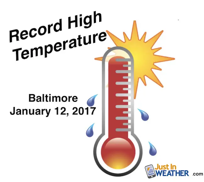
Temperature Info For January 12
70°F – High Temperature at Baltimore
1890 – Prior year this record mark was set for this date
41°F – ‘Normal’ High Temperatures
6.0″ Snow – Top Winter Storm
70s to Snow Not Just For Denver
Think back and you may remember a winter event that came just after we had heat. It is more common than you might imagine. I am a big believer that extreme weather works like a pendulum and swings both ways in a short period of tine. There is a lot of agreement for Saturday snow. Here is a look at the WRF/NAM, Canadian GEM, and GFS Model maps. At this time, here is what I am think:
- It will starting in the morning, likely by sunrise for most… From south to north.
- It will be moderate to heavy at times mid day, early afternoon.
- Boundary will be hard to pin down, but warm air will a lot will battle cold air at the surface. Thew result will be a change over to sleet and freeing rain mid afternoon and evening. Not the best day to travel.
- Totals generally in the 1 to 3 inch range… But I need to fine tune that.
- Ice may be extensive (after starting as snow) for metro Washington and northern Virginia.
- SNOW: This will hit areas that missed out on a lot of the last two system…. Baltimore and on the west side including Montgomery, Howard, Frederick Counties.
- Annapolis area could get in on the early snow of a few inches, then icing during Saturday afternoon.
- I will have more detail and a first call for snowfall map in my evening report.

Canadian GEM Model


GFS Model

Check back
I will have more details and my first call for snowfall in my next post this evening.
Faith in the Flakes Online- Flannel PJs Printed Inside Out
Store Now Open

- We’ve added Flannel PJ Pants that will be printed inside out. They have to be, to make it snow ?
- Free Personal Delivery for orders of 20 items or more to schools and businesses.
- Click this image for the online store.
- Look for more items to be added soon.
- Also see the info for the STEM Assembly Spirit Wear program: Put your school name on the shirts and raise money for you PTO/PTA in the process.
FITF SNOW STICKS
 Available in 2 Ft, 30 Inches, and 3 Ft Sizes. Also with Orange/Black or Purple/Black. Click on the image to see the options offered by my friend Thatcher at Signs By Tomorrow in Timonium.
Go to http://www.signsbytomorrow.com/timonium/ to order yours today! Click the ‘Request a Quote’ button at the top of the page. In comment box include color, size and payment information. Please indicate whether you’d like to have us UPS ship them to you or if you would like to pick up in our store. Snow Sticks will ship or will be ready for pick up in our store 48 hrs after order is placed, Mon-Fri.
Please share your thoughts, best weather pics/video, or just keep in touch via social media
- Facebook: Justin Berk, Meteorologist
- Twitter: @JustinWeather
- Instagram: justinweather
 Get the award winning Kid Weather App I made with my oldest son and support our love for science, weather, and technology. Our 3 year anniversary of the release and our contribution to STEM education is this November. It has been downloaded in 60 countries, and works in both temperature scales. With your support we can expand on the fun introduction to science and real weather.
Sign up for email updates on new posts
Since you may miss some posts via social media, click here for email alerts as a way to make sure you don’t miss any. *You may have to refresh that page once for your browser to clear out the images.
Also See:
My Winter Outlook for 2016-2017: Colder with snow spread out more
NOAA Winter Outlook for 2016 to 2017
La Nina Formed: What it could mean to our winter
Farmers Almanacs Split On Cold And Snow
Extreme Weather of 2015 balanced out on both ends
Low Snow Winters In Baltimore: Records Might Surprise You