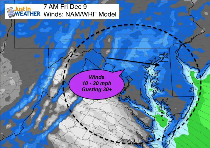
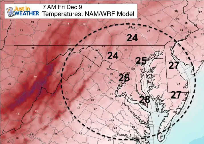
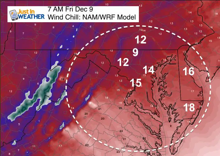
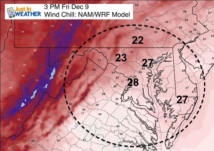
 Thursday December 8 – The cold front has moved through and the colder air will be noticeable Friday morning. Temperatures will drop into the 20s and with winds up to 20 mph and gusting to 30 mph, wind chills will be in the teens. The headlines will be heavy snow along the Great Lakes. Some upper level energy could carry a few flurries over the mountains our way. That is not the snow that you may be questioning. There is still that chance for light snow or flurries on Sunday on the front end of the next storm. A few more opportunities next week. Please note that this early in the season, it takes a storm or two to get an idea which models will behave better. I am not locking in yet on how this storm will track since it is just starting to enter the western US. A lot can still change as it gets fully in the grid. More on that below. First a look at Friday’s weather:
Frigid Friday Morning
Wind Chills
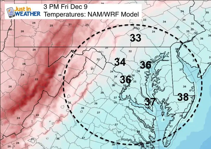
Afternoon Staying Cold
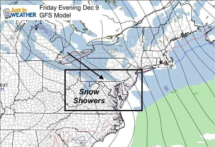
Chance of Snow Flurries?
Upper Level Energy- Vort Max seen here may carry some of the Lake Effect snow showers over the mountains. The best chance will be in the afternoon and early evening.
Surface Map:
Not a lot of moisture, so the models don’t pick up on al the flurries
Weekend Snow?
I want to make this point clear… Light snow or flurries on Sunday will be more likely near and north of Baltimore through southern PA. If you live near I-95 or the Chesapeake Bay, your area is least likely to get in on the wintry action. That is typical early in the season. But the Low Pressure and solution for redevelopment appears to be farther north and west than yesterday’s run. The Canadian is still colder with snow and an icy mix going over to rain Monday. But the GFS continues to be warmer and weaker with the storm… so less snow and more likely rain. I expect the modeling will adjust some more as the Pacific storm enters the grid and gets assessed better before moving our way. Plus, we still need to see how deep this arctic air drops and how long it stays… It can be slower to move out, making the next system more icy and complicated.
Regardless… There is a lot of energy and more chances for snow during next week. We don’t have a big storm on the way, but the shift in the pattern will be noticeable.
Compare the colder Canadian Model to the GFS Model
—> slider
[metaslider id=41019]
GFS Model —> slider
[metaslider id=41028]
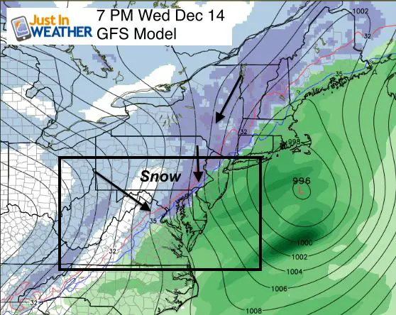
Another Chance of Snow?
There will be a few chances for snow next week. This is one of them.
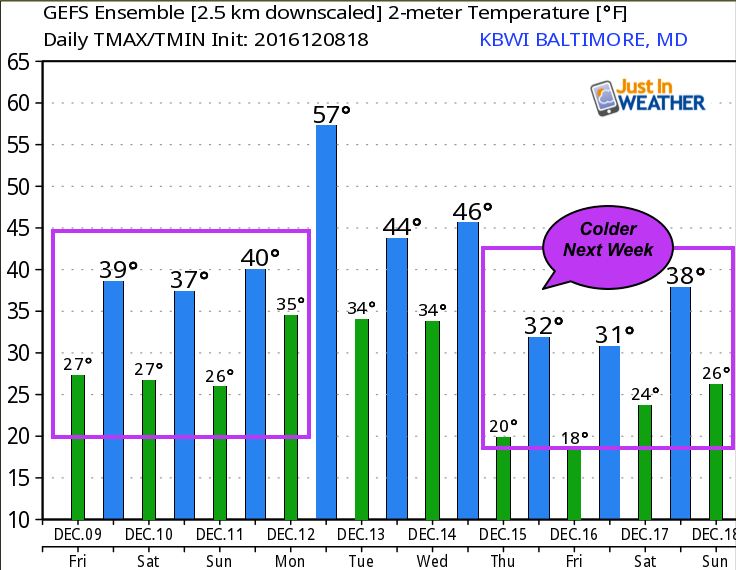
Temperature Outlook – Colder Next Week
Faith in the Flakes Online- Flannel PJs Printed Inside Out
Store Now Open

- We’ve added Flannel PJ Pants that will be printed inside out. They have to be, to make it snow ?
- Free Personal Delivery for orders of 20 items or more to schools and businesses.
- Click this image for the online store.
- Look for more items to be added soon.
- Also see the info for the STEM Assembly Spirit Wear program: Put your school name on the shirts and raise money for you PTO/PTA in the process.
FITF SNOW STICKS
 Available in 2 Ft, 30 Inches, and 3 Ft Sizes. Also with Orange/Black or Purple/Black. Click on the image to see the options offered by my friend Thatcher at Signs By Tomorrow in Timonium.
Go to http://www.signsbytomorrow.com/timonium/ to order yours today! Click the ‘Request a Quote’ button at the top of the page. In comment box include color, size and payment information. Please indicate whether you’d like to have us UPS ship them to you or if you would like to pick up in our store. Snow Sticks will ship or will be ready for pick up in our store 48 hrs after order is placed, Mon-Fri.
Please share your thoughts, best weather pics/video, or just keep in touch via social media
- Facebook: Justin Berk, Meteorologist
- Twitter: @JustinWeather
- Instagram: justinweather
 Get the award winning Kid Weather App I made with my oldest son and support our love for science, weather, and technology. Our 3 year anniversary of the release and our contribution to STEM education is this November. It has been downloaded in 60 countries, and works in both temperature scales. With your support we can expand on the fun introduction to science and real weather.
Also See:
My Winter Outlook for 2016-2017: Colder with snow spread out more
NOAA Winter Outlook for 2016 to 2017
La Nina Formed: What it could mean to our winter
Farmers Almanacs Split On Cold And Snow
Extreme Weather of 2015 balanced out on both ends
Low Snow Winters In Baltimore: Records Might Surprise You