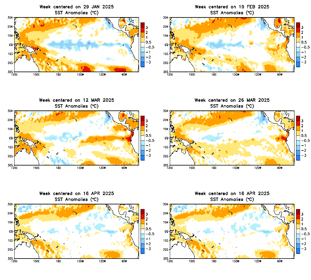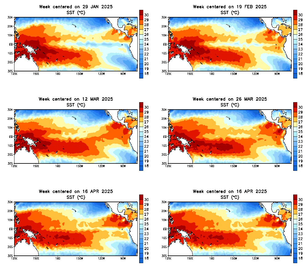
El Nino: Warmer than normal sea surface temperatures in the eastern Pacific
NOAA has been tracking a developing El Nino in the Pacific Ocean all year. An alert for its development was issued in March, and now it appears to be on par with the super El Nino of 1997. Perhaps even stronger. The outlook statement from The Climate Prediction Center:
“There is a greater than 90% chance that El Niño will continue through Northern Hemisphere fall 2015, and around an 85% chance it will last through the 2015-16 winter.”
But what is it? A pattern of warm water the develops every three to seven years in the tropical Pacific along the equator. See more images in the slide show (below the video). The net expected global result:
- Shift of storm development away from Asia towards the central Pacific.
- Shifts the winds from normal light easterlies to westerlies at the surface.
- That adjusts the water currents and weather patterns across the entire Pacific.
- More active tropical season and stronger storms (as already seen in Asia).
- More storms, especially in winter reached the west coast of the US. This can bring drought busting rain to California, but also flooding and mudslides.
- It also increases the westerly winds aloft in the tropical Atlantic. That is opposite the normal flow and cuts the top off of developing systems. This limits the number of tropical storms and hurricanes. However, 1992 was an El Nino year that also brought Hurricane Andrew to south Florida. Once can overcome the pattern and take on a life of its own.
There are other results in South America, but I wanted to stay focused.
It is important to note that El Nino region is nearly half a world away from us. So the eventually impact on the eastern US depends on other patterns as well.
- Sea Surface Temperatures
The diminished tropical action was expected and built into seasonal forecast. Will this mean more snow in the winter? That is more likely but not a guarantee. However, it should be noted that the recent locked pattern of flooding rain can be attributed in part to El Nino, and has been linked to similar patterns in recent decades. But remember that pattern hit Texas and the Mid West hard in May while we were rather dry. That abruptly changed in June, and continues now in July. So as we get closer to fall, the impact of other patterns in the Atlantic will shed light on where the storm track will likely play out. Faith-in-the-Flakes, right?
Related Posts
Expect Media Overload
Back in the 1990s, a media frenzy erupted, blaming everything on the event. I remember one report of a person in California listed as L. Nino in the phonebook receiving death threats. It was comical, and it would be wrong to skip the best El Nino video of all… Chris Farley:
El Nino Charts And Maps
[metaslider id=26859]Keep in touch via social media
- Facebook: Justin Berk, Meteorologist
- Twitter: @JustinWeather
- Instagram: justinweather
- Pinterest: justinweather
SEVERE STORM SAFETY POSTS
- Lightning Safety: Tips, Pics, Video
- 5 Ways Lightning Strikes People
- Lightning Seen From Space: Red Sprites, Blue Jets, Elves
- Hail Safety: Best Improv Video
Get the award winning Kid Weather App I made with my oldest son and support our love for science, weather, technology. Our 2 year anniversary of the release is this November and it has been downloaded in 55 countries. With your support we can expand on the fun introduction to science and real weather:
Also see:
Heart Lightning Discovered Over Baltimore
Top 10 Rainbow Photos From July 6 Storm
July 4th Fireworks Video Over Baltimore: 15 minutes in 48 seconds
Be part of my second 321 mile hiking and biking trek across Maryland this August.
We still have spots open to join my team for a single day OR Have your company logo on our shirt. Last year I raised $22,000 and the week journey was seen by over 1 million people. See more on the Cool Kids Campaign web site and sign up by July 10th to guarantee your spot.


